|
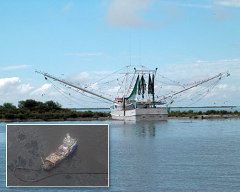
The NOAA is constantly updating fishermen on the status of the closed oil slick area. (Photo: USCG, Petty Officer Casey J. Ranel/ tfhrc.gov)
93 pct of federal Gulf remains open to fishing
 UNITED STATES
Wednesday, May 12, 2010, 23:20 (GMT + 9)
The National Oceanic and Atmospheric Administration’s (NOAA) Fisheries Service (NMFS) has revised the area closed to fishing in the Gulf of Mexico due to the massive BP oil spill. The area now incorporates federal waters seaward of Louisiana’s waters in the locality of Timbalier Island to waters off Choctawhatchee Bay in Florida.
Nancy Thompson, PhD, director of NOAA’s Northeast Fisheries Science Center (NEFSC), will travel to Pascagoula, Mississippi, this week to direct NOAA’s response team. Thompson will collaborate closely with Bonnie Ponwith, PhD, director at the agency’s Southeast Fisheries Science Center, who is leading an intensified effort to check and assess the spill’s influence on Gulf species like red snapper through rapid-response testing entailing chemical analysis of water samples and chemical and sensory analysis of fish and shellfish.
Efforts will be supported by aerial surveys that will track the location of marine animals.
The changes made to the area closed to fishing have left over 93 per cent of the Gulf’s federal waters open for fishing. The changes went into effect on Tuesday.
NOAA also will accelerate updates to the areas closed to fishing in the Gulf and the public notice of those changes. The closure process is being streamlined and, since Tuesday, area boundaries can be modified daily contingent on where and how quickly the oil spill is moving.
 |
| Fishery Closure Boundary as of 11 May 2010. (Map: NOAA) |
NOAA is offering daily updates online by noon EDT and changes to the closed area will become effective at 6 pm EDT on the same day. The six-hour window gives fishers time to retrieve their equipment from any areas about to close, and advance notice of areas set to open for fishing.
A status message will be updated daily regardless of changes; it will also be available on NOAA Weather Radio and by calling NOAA Fisheries southeast regional office.
“We’ve met with Gulf fishermen over the last few weeks and understand their need to receive rapid information,” said Eric Schwaab, NOAA assistant administrator for NMFS.
“NOAA stands shoulder to shoulder with Gulf coast fishermen and their families during these challenging times. Providing frequent updates about closed areas will allow fishermen to make good business and recreational decisions throughout this oil spill event, and will maintain public confidence in seafood from the Gulf of Mexico,” he added.
Modifications to the area closed to all fishing will be based on the oil spill’s location and trajectories, which are impacted by wind speed and direction, currents, waves and other weather patterns. Adjustments will consider fisher and consumer safety.
“Our plan is to use this new expedited process to open fisheries as well,” said Roy Crabtree, NOAA’s Fisheries Service southeast regional administrator. “If an area no longer exhibits oil and we determine through analysis that fish and shellfish are safe to eat, we will re-open that area to commercial and recreational fisheries.”
Meanwhile, NOAA strongly advises fishers to avoid areas where oil or oil sheens are present, whether or not they are outside the closed area.
Related articles:
- Louisiana extends Gulf shrimp ban due to oil spill
- Fishing ban imposed in oil-affected Gulf of Mexico
By Natalia Real
[email protected]
www.seafood.media
|


 Print
Print