|
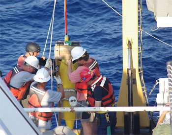
NOAA personnel deploying special instruments to monitor the spill area. The NOAA is addressing the oil spill problem on several fronts. (Photo: NOAA)
NOAA on the move to help tackle oil spill in Gulf
 UNITED STATES
Friday, May 28, 2010, 02:00 (GMT + 9)
The National Oceanic and Atmospheric Administration (NOAA) informed it has been on the scene of the BP oil spill in the Gulf of Mexico from the beginning offering coordinated scientific weather and biological response services to federal, state and local groups.
It has responded by mobilising experts from different fields to try to help contain the expanding oil slick and protect the Gulf’s myriad marine mammals, sea turtles, fish, shellfish and other endangered animals, the agency said.
NOAA spill specialists are advising the US Coast Guard (USCG) on cleanup options, plus counseling all affected federal, state and local partners on marine resources at risk in the affected area. Additionally:
- NOAA experts are conducting aerial surveys to update trajectory maps and track the movement of the oil spill
- NOAA’s National Weather Service is providing regular weather forecasts to facilitate federal planning and response efforts
- Surveillance flights are assessing the species and populations the oil may reach
- NOAA also is using experimental satellite data from its Satellite Analysis Branch to survey the extent of spill-related Gulf pollution
On Wednesday, NOAA informed that its shoreline cleanup assessment efforts will incorporate additional beaches farther west to cover the oil’s growing reach. A new operational centre will open in New Iberia, Louisiana, in the next few days.
The teams also assess beaches before they are polluted with oil to plan for the most appropriate cleanup methods if the area is hit by the spill.
The agency and the University of New Hampshire Coastal Response Research Centre are sponsoring a workshop on Wednesday and Thursday on dispersants at Louisiana State University.
NOAA’s Damage Assessment Remediation and Restoration Programme is running a Natural Resource Damage Assessment. Its current focus is to assemble data on resources and their habitats and collect baseline (pre-spill impact) data.
Data is also being collected on oiled resources and habitats.
As of Tuesday, NOAA aircrafts were deployed throughout the southern US to study oil density and thickness, conduct mammal surveys and photograph and map the Gulf’s coast with another flight planned for Friday.
NOAA and contract research vessel Gordon Gunter is departing port on Thursday to visit the site of the main release and inform fishery closure decisions. The vessel was originally set to depart on 22 May but suffered from technical difficulties.
The agency has also deployed a few other vessels.
National Marine Fisheries Service (NMFS) revised the fishery closure effective on Tuesday, which now envelops slightly over 22 per cent of the federal waters in the Gulf exclusive economic zone.
Related articles:
- Gulf of Mexico fishing ban extended
- More Gulf fishing banned as oil fears grow for Florida
- Major US fishery takes a beating after oil spill
By Natalia Real
[email protected]
www.seafood.media
Photo Courtesy of FIS Member  National Oceanic and Atmospheric Administration NOAA/NMFS National Oceanic and Atmospheric Administration NOAA/NMFS
|


 Print
Print