|

Preparing to deploy a sea glider in the Arctic. Scientists use gliders to collect oceanographic data and study the underwater world. (Image: David Wa
Interactive: Mapping the wonders of the underwater world
 WORLDWIDE WORLDWIDE
Wednesday, September 07, 2022, 07:00 (GMT + 9)
The following is an excerpt from an article published by China Dialogue Ocean:
The ocean floor is home to myriad landforms, but with only 20% of it yet mapped in detail, many more await discovery
To properly map the ocean floor is a long and costly undertaking. Satellites may have already mapped 100% of it, but they have done so in low resolution, missing every feature smaller than 1.5km. So far, only one-fifth has been closely mapped using modern sonar technology, according to UNESCO.

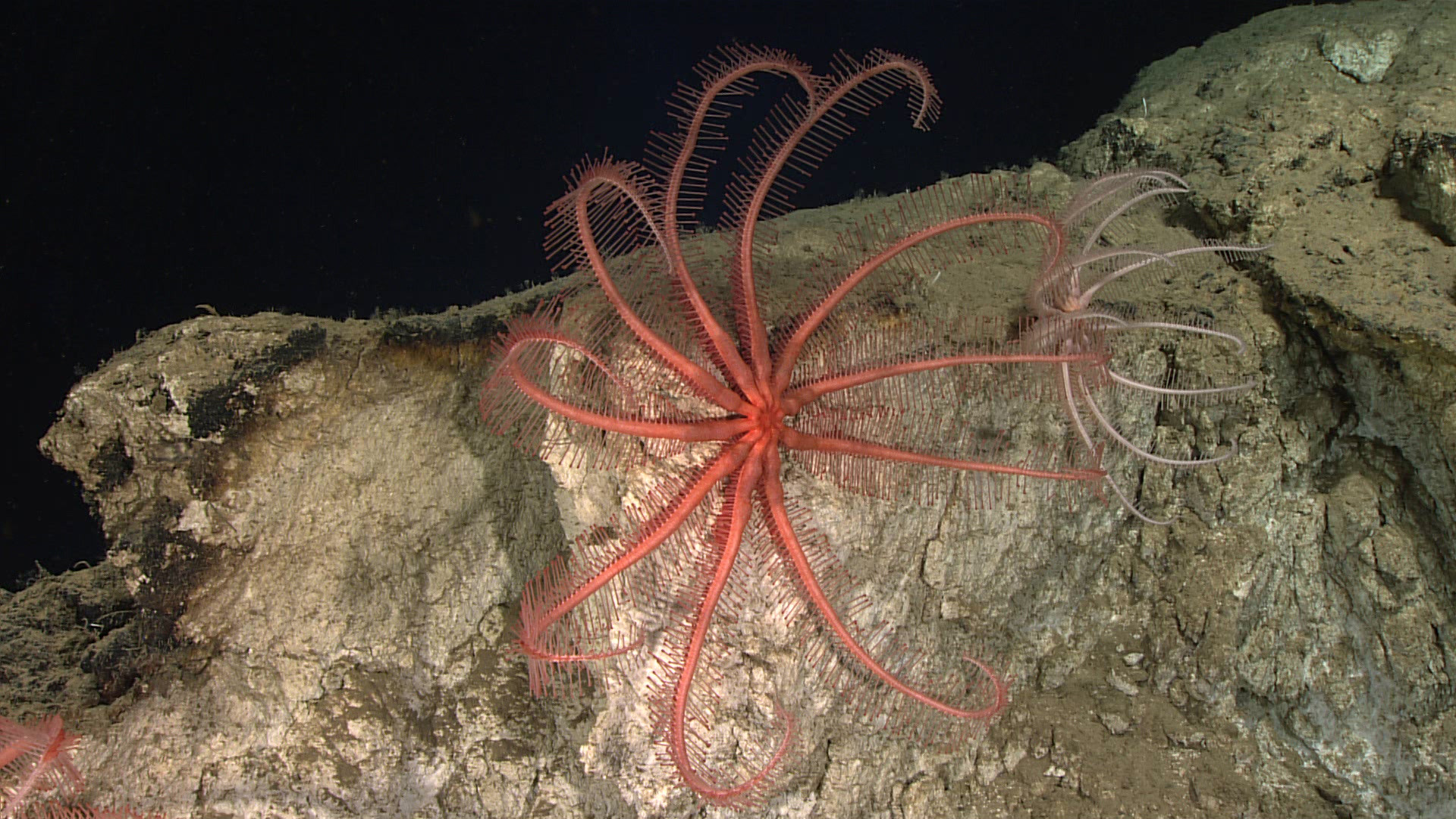
A Brisingid seastar on the side of the Mona Canyon off the coast of Puerto Rico (Image: NOAA/ Flickr, CC BY-SA 2.0)
If we consider that the ocean covers more than 70% of the Earth’s surface, that’s a great deal of underwater terrain yet to be well explored. A growing movement is trying to change this. In the last five years, the amount of seafloor mapped in great detail has risen from 6% to 20%. Earlier this year, UNESCO announced it will partner with countries and companies to try and take that up to 80% by 2030. Various technological innovations, such as sonar attached to autonomous vessels, are opening up new avenues for progress towards that goal.
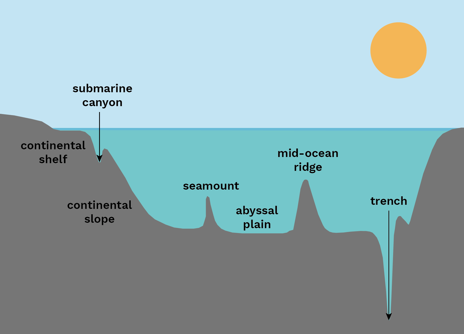
In their expeditions, ocean explorers have found very complex landscapes: thousands of impressive underwater features including lofty mountain ridges and incredibly deep trenches. It’s possible to split these features into seven main kinds:

Graphic by China Dialogue Ocean. Based on a figure in The Law of Seabed (2020).
Abyssal plains
The huge flat bottoms of the deep ocean. Covered by fine-grained sediment like clay and silt, abyssal plains are also peppered with “abyssal hills” and underwater mountains known as seamounts.
Continental shelves
The underwater extension of a continent – usually wide along low-lying land and narrow along mountainous coasts.
Continental slopes
The sloped bottom of the ocean that extends from the continental shelf down to the abyssal plain.
Mid-ocean ridges
Mountain ranges on the ocean floor that mark the boundaries between tectonic plates, where magma wells up and new ocean floor is formed.
Seamounts
A mountain, usually formed of volcanoes, rising from the seafloor but not reaching above the surface of the water.
Trenches
The deepest parts of the ocean, trenches are formed by subduction – when a tectonic plate slides beneath another and forms a steep V-shaped depression. The world’s deepest point lies in the Mariana Trench in the Pacific Ocean. Known as Challenger Deep, it is more than 2,000 metres further from sea level than the Earth’s highest point, Mount Everest.
Submarine canyons
Narrow, steep-sided valleys that cut into continental slopes. They have steep rocky sides that can be thousands of metres tall. Those of the Grand Bahama Canyon, which are thought to be the highest, rise nearly 5km from the canyon floor. The walls of the Grand Canyon in Colorado, by comparison, measure about 1.6km at their tallest. Submarine canyons are found along continental slopes, unlike trenches, which tend to be deeper down where tectonic plates meet.
.jpg)
State-of-the art equipment for deep-sea research. A: Autonomous Underwater Vehicle Hugin from Kongsberg Maritime (Norway). B: human occupied vehicle Alvin from USA. C: Remote Operated Vehicle Triton (Norway). D: Remoted Operated Vehicle Isis from the UK. Photo courtesy from Deep-Sea Ecosystems: Biodiversity and Anthropogenic Impacts
The features were chosen using different criteria: the trenches are some of the deepest in the world; the ridges are some of the longest and highest known in each of the world’s major oceans; while the seamounts and canyons are the largest or best known. (continues...)
Author / Source: Marta Portocarrero, Regina Lam / China Dialogue Ocean / Read the full article by clicking the link here
[email protected]
www.seafood.media
|


